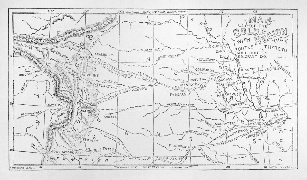
Map of the Gold Region, Published in The Weekly by American School

Map of the Gold Region, Published in The Weekly

(Map of the Gold Region, published in The Weekly )


American School

€ 0.00
Enthält ??% MwSt.
   Add to cart
   Configure art print
Undated  ·  lithograph  ·  Picture ID: 425476

Cultural Circles  ·  Cartography

Map of the Gold Region, Published in The Weekly by American School. Available as an art print on canvas, photo paper, watercolor board, uncoated paper or Japanese paper.
fort kearney · laramie · nebraska · kansas · south west · southwest
zu Favoriten hinzufügen   Add to favorites    Select wall color    View painting in a room AR/3D   View in 3D / AR
0 Reviews

Configure art print

Picture Frame

Medium & Stretcher

Glass & Passepartout

Miscellaneous & Extras

 Save / compare configuration
Preview Icon

Summary

Gemälde
Veredelung
Keilrahmen
Museumslizenz

€ ???.??
(inkl. 20% MwSt)
   Add to cart

Produktionszeit: 2-4 Werktage
Bildschärfe: PERFEKT

Should you desire adjustments to brightness and color, or a custom crop of the motif, we are happy to make these changes at no additional cost to you. Please do not hesitate to contact us.

Similar artworks selected for you

The Euphrates and Tigris Map of Chile Map of North America with Locations of Native American Tribes Manasseh, Beyond Jordan Northern Italy - Illustrating the Campaigns of 1796 and 1797, 1896 Map of the Field of Operations in 1814 Map of the parts of Europe and Asia adjacent to Constantinople, from The Jordan and the Dead Sea Map of Tibet and Central Asia of Mr. Prjevalsky Map of the Marengo Campaign, 1800 The Course of the River Amazon Colonial America: the Dutch Colony of New Netherland Marco Polo Basin of the Amazons Map of Slavery in the United States Geographic map of the empire of Morocco in 859. Engraving in Le Monde Illustré n°129 of 1 October 1859. Map Showing March of General Roberts to Peiwar Kotal Nov. 28 to Dec. 1, 1878 Map of the Theatre of War in the Transvaal, c. 1880 Atlantis: a map showing the location of the mythical continent, c1882 1956 Gaul Chart of the Arctic Regions Showing the North West Passage Connecting the Atlantic and Pacific Oceans The Carpathian Passes, 1919 New Atlas of China, Chinese Tartary, and Tibet, The Hague 1737 Plan of General Burrows March to the Helmund, July 4-29, 1880 Map of Northern and Central Italy, 1890 Geographic map of the United States of America in March 1861. Slavery states are represented in the run. Written in white, the names of the seven confederate states that separated from the Union: Texas, South Carolina, Mississippi, Florida, Alabama, Georgi Geographic map of the Principality of Monaco, in 1861, before the city of Roquebrune and Menton joined France - engraving in Captaincy of São Paulo in 1766, in the Chorographic Map of the Boundaries of the State of Minas Gerais with São Paulo The Armenian Massacres of 1915, First World War
Show more similar artworks

Other art prints by American School

The Port of New York: Bird Hoffman House Bouquet Cigars, 1893 Statue of Germania on the Niederwald The Battle of Little Big Horn, June 25th 1876, 1889 Farewell address of the late General George Washington, 17th September 1796 Franco-Prussian War 1870-1871: The surrender of Napoleon III after the battle of Sedan, 2 September 1870 - Color line engraving, American, c1871 - War of 1870: Napoleon III (1808-1873) prisoner following the battle of Sedan meets William I of Prussia (1797 Poster advertising The Sandow Trocadero Vaudevilles c.1894 Miss Pearce Portrait of Samuel Colt, inventor of the revolver Signature of John Hancock Map of Africa Showing Its Most Recent Discoveries with the Island of St. Helena Inset from Mitchell Poster Advertising California, Cornucopia of the World, published by Rand McNally & Co. Pallas Athene, Illustration from History of Greece by Victor Duruy, Published 1890 Portrait of Robert Edward Lee
Discover more works by American School

Other motives from the category Cartography

World Map with Jerusalem in the Centre (from Map of Asia Minor Showing Norway, Sweden, Denmark, Lapland, Poland, Turkey, Russia and the Moscow Region, c.1626 Map of the Battle of Lutzen, 1848 Map of the Southern Sky, with representations of constellations, decorated with the crest of Cardinal Lang von Wellenburg, and a dedication to him with his coats of arms and the Imperial copyright Map of the Northern Sky with Representations of the Constellations A New and Correct Map of the World, 1770-97 Map of Silesia, from an Atlas A Map of Moorfields and Hoxton, London, 1746 Map of the China Sea, from a Facsimile of the Map of Australia, from Map of Venice, published by H. Chatelain in Amsterdam, 1728 Battle of Waterloo, Map of the Battlefield, Engraved by Jacowick, 1816 Map of Regent Map of Aleppo, c.1600 Seat of War in the Crimea, Map of the Country between Simpheropol and Baidar to Illustrate the Movements of the Allied and Russian Armies
View More from "Cartography"

Excerpt from our top sellers

Hunters in the Snow (Winter) Starry Night Balaam and his Ass Morning in the Mountains Hunters in the Snow Blue Fox A Man Urinating, 1631 Female Nude Christ and the Disciples of Emmaus P. Mönsted, Sunny Forest Stream Christ with Arms Folded Actaeon Surprises the Goddess Artemis (Diana) Bathing with Her Companions Caricature: Series of Ridiculous Expressions The Girl with a Pearl Earring The Goldfish
Show More Artworks


What our customers think about us


Frequently Asked Questions about Meisterdrucke


Personalizing your art print at Meisterdrucke is a simple and intuitive process that allows you to design an artwork exactly to your specifications: Choose a frame, determine the image size, decide on a printing medium, and add suitable glazing or a stretcher frame. We also offer customization options such as mats, fillets, and spacers. Our customer service is available to help you design your perfect artwork.

At Meisterdrucke, you have the fascinating option to visualize the artwork you configured directly in your own space. For a tailored preview, simply upload a photo of your room and let the artwork appear on it. If you visit us via a mobile device, be it a phone or tablet, our augmented reality feature brings the image to life and seamlessly projects it into your space. An experience that uniquely combines art and technology.

Choosing the medium is often a matter of personal taste. To give you a clearer idea, we have provided some images for each medium. For a holistic experience, we also offer you a sample set of all paper variants so you can make a decision not just visually but also haptically. You can take advantage of the sample set free of charge – only the shipping costs will apply. You can order the sample set directly.

Do not worry. At Meisterdrucke, we do not proceed mechanically. We manually review each order. If there are any inconsistencies or peculiarities in the configuration, we will immediately contact you. Of course, our courteous and patient support is always at your side to assist you with the configuration. Together with you, we adjust your image by phone or email so that the final result exactly meets your expectations.


Do you have any questions?

Are you interested in an art print from our manufactory but still unsure? Do you need advice on choosing the medium or help with the order?

Our experts are happy to assist you.

+43 4257 29415
support@meisterdrucke.com
Mo-Do: 7:00 - 16:00 | Fr: 7:00 - 13:00

Do you have any questions?

Are you interested in an art print from our manufactory but still unsure? Do you need advice on choosing the medium or help with the order?

Our experts are happy to assist you.

+43 4257 29415
support@meisterdrucke.com
Mo-Do: 7:00 - 16:00 | Fr: 7:00 - 13:00


Meisterdrucke

   Kärntner Strasse 46
        9586 Finkenstein am Faaker See
        Austria
        +43 4257 29415
        support@meisterdrucke.com
Other languages

                   
Erfahrungen & Bewertungen zu Meisterdrucke
Partner Logos

Kaiser Franz Joseph

Meisterdrucke
Kärntner Strasse 46
9586 Finkenstein am Faaker See · Austria
+43 4257 29415 · office@meisterdrucke.com
Partner Logos


(c) 2023 meisterdrucke.uk