Search by artist, work title or style – e.g. Monet, Starry Night, Impressionism, Hokusai wave, nude. Describe the scene – e.g. green meadow, abstract with lots of red, dark oil painting, standing nude next to a tree.

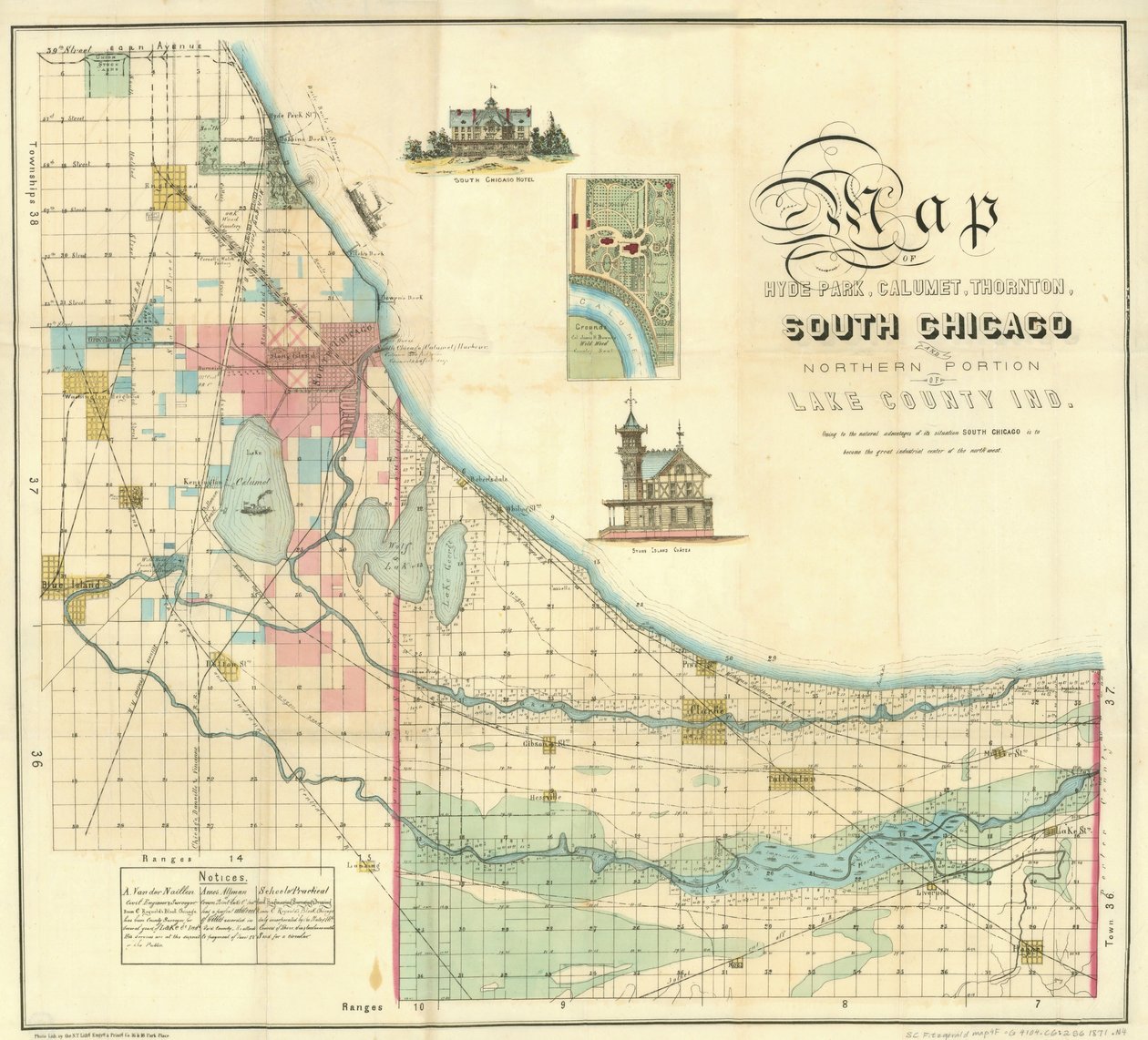
Map of South Chicago by American School

Map of South Chicago

(Map of South Chicago, 1871 )


American School

€ 104.94
Enthält 0% MwSt.
   Configure art print
1871  ·  colour lithograph  ·  Picture ID: 437878

Cultural Circles  ·  Cartography

Map of South Chicago by American School. Available as an art print on canvas, photo paper, watercolor board, uncoated paper or Japanese paper.
american city · urbanisation · industrialisation · street map · south chicago hotel · stony island chateau · mapping · cartography · illinois · centre · midwest · Newberry Library, Chicago, Illinois, USA / Bridgeman Images
AR/3D   View in 3D / AR zu Favoriten hinzufügen   Add to favorites    Select wall color    View painting in a room
0 Reviews

Configure art print

Picture Frame

Medium & Stretcher

Glass & Passepartout

Miscellaneous & Extras

 Save / compare configuration
Preview Icon

Summary

Gemälde
Veredelung
Keilrahmen
Museumslizenz

€ 104.94
(inkl. 20% MwSt)
   Add to cart

Bildschärfe: PERFEKT

Should you desire adjustments to brightness and color, or a custom crop of the motif, we are happy to make these changes at no additional cost to you. Please do not hesitate to contact us.

Similar artworks selected for you

Rand McNally & Company Chicago map Plan of Chicago, Chicago, Illinois, Diagram Showing City Growth Rees Map of Cook And DuPage Counties Plate 5, Map of the Whole Incorporated City of Philadelphia, 1867 Critical Map of the Business Portion of Chicago Map of Chicago and Suburbs Chicago Terminal Transfer Railroad Co. map showing property of railroads in the business center of Chicago, c.1898 City of Chicago Map Plan of Chicago, Chicago, Illinois, Railroad Circuits Diagram City of Chicago Map Plan of the City of Washington - The Capitol of the United States of America Plan of Chicago, Chicago, Illinois, Railroad Circuits Diagram Plate 111 from The Plan of Chicago Sanborn Fire Insurance Map from Lansing, Ingham County, Michigan Fireman Chicago As It Is, Showing the Burnt District, from History of the Great Fires in Chicago and the West Map of the consolidated city of Brooklyn, 1861 Scott Floyd County, Ga. Embraces 512 Square Miles of the Most Picturesque and Fertile Lands, Conceded to the State Cherokee Indians Plate 91 from The Plan of Chicago, Chicago, Proposed Diagonal Arteries, 1909 Map of the City and County Environs of New York with Original Characters and Illustrations, 1850 Map of Philadelphia County, 1819 Baist Shows Real-Property Tracts and Owners New-York City, County, and vicinity Map of American Indian trails and villages Map of the City of New York Plate LXXIII from Plan of Chicago
Show more similar artworks

Other art prints by American School

Hoffman House Bouquet Cigars, 1893 The Port of New York: Bird Statue of Germania on the Niederwald Poster advertising The Sandow Trocadero Vaudevilles c.1894 California, Cornucopia of the World, published by Rand McNally & Co. Farewell address of the late General George Washington, 17th September 1796 Franco-Prussian War 1870-1871: The surrender of Napoleon III after the battle of Sedan, 2 September 1870 - Color line engraving, American, c1871 - War of 1870: Napoleon III (1808-1873) prisoner following the battle of Sedan meets William I of Prussia (1797 Map of Africa Showing Its Most Recent Discoveries with the Island of St. Helena Inset from Mitchell Advertisement for Dentacura Dentifrice, from Theatre Magazine, England, 1901 The Panama Canal, Pacific and Atlantic oceans kissing Robert Fulton Poster Advertising Signature of John Hancock The Battle of Little Big Horn, June 25th 1876, 1889 Pallas Athene, Illustration from History of Greece by Victor Duruy, Published 1890
Discover more works by American School

Other motives from the category Cartography

Renaissance map of Europe, Jacopo Russo (after) 1528 Renaissance map of Europe, Jacopo Russo (after) 1528 Map of the City of New York as Laid Out by the Commissioners, 1814 Europe and Central Asia, from an Atlas of the World in 33 Maps, Venice, 1st September 1553 Ms. 988 Vol.3, fol.61 Map depicting North America as Divided by the European Powers, 1774 Map of Fredericksburg, December 1862 Map of the Eastern Part of the Roman Empire, from Copy of an 8th Century Beatus Mappamundi Map Depicting the North of Africa, from an Atlas by Ptolemy, 1st Half 16th Century Map of the Ottoman Empire, Kingdom of Greece, and the Russian Provinces on the Black Sea Asia: Map of the Continent Including Japan and the East Indies with Part of New Guinea, c.1580 Map of Southern Italy, Corsica, and Sardinia Known in Ancient Times as Great Greece or Magnia Graecia Map of Canada and Florida, from Map of Montpellier, from
View More from "Cartography"

Excerpt from our top sellers

Two Reclining Figures Tetrahedra View on Delft Seated Nude Back View Standing Half-Nude with Brown Shirt Krumau The Entrance to the Grand Canal, Venice, ca 1730 Shichiri Beach in Sagami Province Birds and Flowers of Spring and Summer The Sailing Boat, Evening Effect The Virgin with Angels Pear Blossom, 1882 The Equatorial Jungle, 1909 The Birth of Venus (edited) The Convalescent. 1888
Show More Artworks


What our customers think about us


Frequently Asked Questions about Meisterdrucke


Personalizing your art print at Meisterdrucke is a simple and intuitive process that allows you to design an artwork exactly to your specifications: Choose a frame, determine the image size, decide on a printing medium, and add suitable glazing or a stretcher frame. We also offer customization options such as mats, fillets, and spacers. Our customer service is available to help you design your perfect artwork.

At Meisterdrucke, you have the fascinating option to visualize the artwork you configured directly in your own space. For a tailored preview, simply upload a photo of your room and let the artwork appear on it. If you visit us via a mobile device, be it a phone or tablet, our augmented reality feature brings the image to life and seamlessly projects it into your space. An experience that uniquely combines art and technology.

Choosing the medium is often a matter of personal taste. To give you a clearer idea, we have provided some images for each medium. For a holistic experience, we also offer you a sample set of all paper variants so you can make a decision not just visually but also haptically. You can take advantage of the sample set free of charge – only the shipping costs will apply. You can order the sample set directly.

Do not worry. At Meisterdrucke, we do not proceed mechanically. We manually review each order. If there are any inconsistencies or peculiarities in the configuration, we will immediately contact you. Of course, our courteous and patient support is always at your side to assist you with the configuration. Together with you, we adjust your image by phone or email so that the final result exactly meets your expectations.


Do you have any questions?

Are you interested in an art print from our manufactory but still unsure? Do you need advice on choosing the medium or help with the order?

Our experts are happy to assist you.

+43 4257 29415
support@meisterdrucke.com
Mo-Do: 7:00 - 16:00 | Fr: 7:00 - 13:00

Do you have any questions?

Are you interested in an art print from our manufactory but still unsure? Do you need advice on choosing the medium or help with the order?

Our experts are happy to assist you.

+43 4257 29415
support@meisterdrucke.com
Mo-Do: 7:00 - 16:00 | Fr: 7:00 - 13:00


Meisterdrucke

   Kärntner Strasse 46
        9586 Finkenstein am Faaker See
        Austria
        +43 4257 29415
        support@meisterdrucke.com
Other languages

                   
Erfahrungen & Bewertungen zu Meisterdrucke
Post.at DHL Express Quehenberger Cargoboard
Kaiser Franz Joseph

Meisterdrucke
Kärntner Strasse 46
9586 Finkenstein am Faaker See · Austria
+43 4257 29415 · office@meisterdrucke.com
Post.at DHL Express Quehenberger Cargoboard


Meisterdrucke 2755 Bewertungen auf ProvenExpert.com

(c) 2025 meisterdrucke.uk