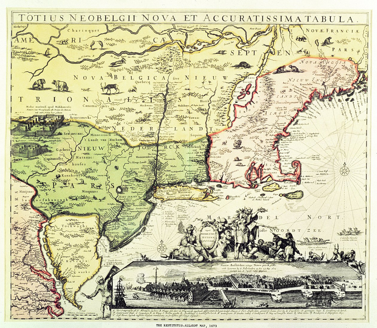
The Restitutio-Allardt Map of New Amsterdam, Engraved and Published by Carolus Allardt, 1673 by Dutch School

The Restitutio-Allardt Map of New Amsterdam, Engraved and Published by Carolus Allardt, 1673

(The Restitutio-Allardt Map of New Amsterdam, engraved and pub. by Carolus Allardt, 1673 (copper engraving))


Dutch School

€ 0.00
Enthält ??% MwSt.
   Add to cart
   Configure art print
1673  ·  coloured copper engraving  ·  Picture ID: 414790

Cultural Circles  ·  Cartography

The Restitutio-Allardt Map of New Amsterdam, Engraved and Published by Carolus Allardt, 1673 by Dutch School. Available as an art print on canvas, photo paper, watercolor board, uncoated paper or Japanese paper.
new amsterdam · view · port · indigenous animals · new netherland · new york · america · american · North America
zu Favoriten hinzufügen   Add to favorites    Select wall color    View painting in a room AR/3D   View in 3D / AR
0 Reviews

Configure art print

Picture Frame

Medium & Stretcher

Glass & Passepartout

Miscellaneous & Extras

 Save / compare configuration
Preview Icon

Summary

Gemälde
Veredelung
Keilrahmen
Museumslizenz

€ ???.??
(inkl. 20% MwSt)
   Add to cart

Produktionszeit: 2-4 Werktage
Bildschärfe: PERFEKT

Should you desire adjustments to brightness and color, or a custom crop of the motif, we are happy to make these changes at no additional cost to you. Please do not hesitate to contact us.

Similar artworks selected for you

Totius Neobelgii Nova et Accuratissima Tabula, 1674 Novi Belgii Map of New Belgium with a View of New Amsterdam, compiled by Nicolaes Visscher c.1651-55 New Belgium, plate from North America New Netherland and New England, 1682 Map of Canada from Chart of southern United States showing Mississippi river and Saint Louis, c. 1720 Map of New Amsterdam, c.1650 A General Map of the Middle British Colonies in America; viz. Virginia, Maryland, Delaware, Pennsylvania, New Jersey, New York, Connecticut, and Rhode Island: of Aquanishuonigy, the Country of the Confederate Indians... Of the Lakes Erie, Ontario and Ch Map of Ingria with View of Saint Petersburg The Famous West Indian Voyage Made by the English Fleet of 23 Ships and Barks A Map of New England and New York from John Speed A Map of the Most Inhabited Part of New England, Containing the Provinces of Massachusetts Bay and New Hampshire with the Colonies of Connecticut and Rhode Island Map of the Canal du Midi, with its aqueducts Canada, English Colonies with Louisiana and Florida Pennsylvania, New York, southern New Jersey, with the western part of Connecticut, Massachusetts Bay and Land of the Iroquois, engraving by G. Zuliani taken from Tome I of the Map of New France dedicated to Colbert by Duchesneau, Intendant, 1681 Montana, North Dakota, Minnesota, Wisconsin, Michigan, New York, Wyoming, South Dakota, Nebraska, Iowa, Illinois, Indiana, Ohio, Pennsylvania, Colorado, Kansas, Missouri, Kentucky, West Virginia, Oklahoma, Arkansas, Tennessee, Texas, Louisiana, Mississippi Map of Andalusia, Spain North-East Coast of America, from The Caribbean Sea: The Bermuda Triangle between the Bermuda Archipelago, Miami, and Puerto Rico. According to Wilhelm Blaeu Map of New England and Northern Chesapeake Region Map of the British Dominions of North America, 1772 Map of Africa, from The Promised Land Canaan Map of the Dominions of Great Britain in North America, 1711 Taurica Chersonesus. Map of the Crimea Map of the United States of America According to the Treaty of Peace of 1783
Show more similar artworks

Other art prints by Dutch School

Martin Luther preaching (detail) Map of New Holland, Now Australia, and of New Zealand A Planisphere with Signs of Zodiac Terrarum Orbis Tabula (after G. a Schagen, c.1689) A Dodo Plaque with a Chinoiserie Landscape and Gilt Details, c.1680 China Miracle of Our Lady of Nazare, Our Lady of Nazare Church, Portugal Map of the Strait of Magellan, plate from Oliver van Noort Portrait of a Man, 1575 Map of the Cape of Good Hope. Table Bay, South Africa Interior of a Dutch House, 1st Half of 17th Century Island of Formosa (Taiwan) Draining fluid from a Hydrocele of the Scrotum, from Exercitationes Practicae circa Medendi Methodum by Frederik Dekkers, 1694 Ptolemy Philadelphus, King of Egypt, summons 72 men from Judaea to translate Jewish law into Greek, c.1700
Discover more works by Dutch School

Other motives from the category Cartography

Map of the Environs of the Town and Castle of Oléron, from the Atlas of Louis XIV Map of the Atlantic Ocean, c.1550 Map of the Suez Canal, c.1870 Renaissance map of Europe, Jacopo Russo (after) 1528 Map of the Ottoman Empire, Kingdom of Greece, and the Russian Provinces on the Black Sea Map of the City of Ancient Rome During Its Greatness, BC 30-AD 400 Detailed map of Gallipoli Peninsula and the Dardanelles Turkey, from Map of Venice, published by H. Chatelain in Amsterdam, 1728 Map of North America, 1747 Ethiopia, the Red Sea and Saudi Arabia, from an Atlas of the World in 33 Maps, Venice, 1st September 1553 (Detail) Map of the south of England, including London, Surrey and Sussex Map of North America, showing the boundaries of the United States, Canada and the Spanish Possessions, according to the proposals of the Court of France in 1782, from Maps of Galway, Dublin, Limerick, and Cork, from Map of Paris in 1789 Map of Prague, from
View More from "Cartography"


What our customers think about us


Frequently Asked Questions about Meisterdrucke


Personalizing your art print at Meisterdrucke is a simple and intuitive process that allows you to design an artwork exactly to your specifications: Choose a frame, determine the image size, decide on a printing medium, and add suitable glazing or a stretcher frame. We also offer customization options such as mats, fillets, and spacers. Our customer service is available to help you design your perfect artwork.

At Meisterdrucke, you have the fascinating option to visualize the artwork you configured directly in your own space. For a tailored preview, simply upload a photo of your room and let the artwork appear on it. If you visit us via a mobile device, be it a phone or tablet, our augmented reality feature brings the image to life and seamlessly projects it into your space. An experience that uniquely combines art and technology.

Choosing the medium is often a matter of personal taste. To give you a clearer idea, we have provided some images for each medium. For a holistic experience, we also offer you a sample set of all paper variants so you can make a decision not just visually but also haptically. You can take advantage of the sample set free of charge – only the shipping costs will apply. You can order the sample set directly.

Do not worry. At Meisterdrucke, we do not proceed mechanically. We manually review each order. If there are any inconsistencies or peculiarities in the configuration, we will immediately contact you. Of course, our courteous and patient support is always at your side to assist you with the configuration. Together with you, we adjust your image by phone or email so that the final result exactly meets your expectations.


Do you have any questions?

Are you interested in an art print from our manufactory but still unsure? Do you need advice on choosing the medium or help with the order?

Our experts are happy to assist you.

+43 4257 29415
support@meisterdrucke.com
Mo-Do: 7:00 - 16:00 | Fr: 7:00 - 13:00

Do you have any questions?

Are you interested in an art print from our manufactory but still unsure? Do you need advice on choosing the medium or help with the order?

Our experts are happy to assist you.

+43 4257 29415
support@meisterdrucke.com
Mo-Do: 7:00 - 16:00 | Fr: 7:00 - 13:00


Meisterdrucke

   Kärntner Strasse 46
        9586 Finkenstein am Faaker See
        Austria
        +43 4257 29415
        support@meisterdrucke.com
Other languages

                   
Erfahrungen & Bewertungen zu Meisterdrucke
Partner Logos

Kaiser Franz Joseph

Meisterdrucke
Kärntner Strasse 46
9586 Finkenstein am Faaker See · Austria
+43 4257 29415 · office@meisterdrucke.com
Partner Logos


(c) 2023 meisterdrucke.uk