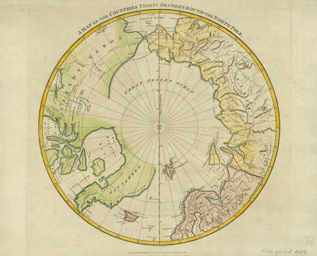
A Map of the Countries Thirty Degrees round the North Pole, from

A Map of the Countries Thirty Degrees round the North Pole, from 'Atlas to Crutwell's Gazetteer' by Clement Crutwell

(A Map of the Countries Thirty Degrees round the North Pole, from 'Atlas to Crutwell's Gazetteer' by Clement Crutwell (1743-1808) published London, 1799 )


Samuel John Neele

€ 111.53
Enthält 0% MwSt.
   Configure art print
1799  ·  coloured engraving  ·  Picture ID: 167945

Nonclassified artists  ·  Cartography

A Map of the Countries Thirty Degrees round the North Pole, from 'Atlas to Crutwell's Gazetteer' by Clement Crutwell by Samuel John Neele. Available as an art print on canvas, photo paper, watercolor board, uncoated paper or Japanese paper.
Newberry Library, Chicago, Illinois, USA / Bridgeman Images
zu Favoriten hinzufügen   Add to favorites    Select wall color    View painting in a room AR/3D   View in 3D / AR
0 Reviews

Configure art print

Picture Frame

Medium & Stretcher

Glass & Passepartout

Miscellaneous & Extras

 Save / compare configuration
Preview Icon

Summary

Gemälde
Veredelung
Keilrahmen
Museumslizenz

€ 111.53
(inkl. 20% MwSt)
   Add to cart

Bildschärfe: PERFEKT

Should you desire adjustments to brightness and color, or a custom crop of the motif, we are happy to make these changes at no additional cost to you. Please do not hesitate to contact us.

Similar artworks selected for you

Polar Projection Map with Arctic Circle, c.1680 Map of the Southern Lands between the Tropic of Capricorn and the Antarctic Pole Northern Hemisphere to See More Clearly the Arctic Lands Southern Hemisphere of the Earth cut at the equator, engraving by G. Zuliani taken from Tome I of the Newest Atlas published in Venice in 1779 by Antonio Zatta Map of Northern Hemisphere, Arctic Land Description Arctic Earths Map of the North Pole and Northern Areas (1628) A Map of the North Pole Ice Chart of the Southern Hemisphere Compiled from the Voyages of Cook 1772-5, Bellingshausen 1819-21... and Shackleton 1908-9 Hydrographical Chart of the Arctic Regions Map of the Mercator Projection North of World The Antarctic Pole Septentrionalium Terrarum descriptio, 1595 Polus Antarcticus Humfray Gylbert knight his charte View of the South (Antarctic) Pole (Atlas by Guillaume Delisle) The North Polar Regions World Map with Magellan’s Circumnavigation from Scherer’s Atlas Novus Chart of the Southern Hemisphere Showing Pre-Cook Journeys and Discoveries Map of the Pacific Ocean engraved in Venice in the 18th century Terra Australis Chart of the Arctic Regions from the Admiralty Surveys, Third Edition Ancient Hemispheres of the World, plate 94 from Map of the South Pole, 1912 The Charter of Sir Humphrey Gilbert North Polar Regions General Map of the Earth Map of the New Discoveries to the North of the South Seas, 1750
Show more similar artworks

Other motives from the category Cartography

Map of Florence, 1584 Patagonia, from a Series of World Maps published by John Tallis und Co., New York and London, 1850s Map of Spain and Portugal Kankou Mousa, King of Mali, from the Map of Charles V, Map of Mecia de Viladestes, a Portulan of Europe and North Africa, 1413 Map of Avignon, from Map of the Travels of Alexander the Great (356-323 BC) from Detail from a Map of Paris in the Reign of Henri II Showing the Quartier des Ecoles, 1552 Map of Orleans and Bourges, from Map of Naples, c.1600 Map of Spain and Portugal showing the political divisions in the country at the death of Alfonso III, King of Leon, from Renaissance map of Europe, Jacopo Russo (after) 1528 Map of Berlin, 1737 Map of the World, Map of the Tribe of Asher, 1590 Map of the New England coastline in 1614, engraved by Simon de Passe
View More from "Cartography"

Excerpt from our top sellers

The Great Wave off Kanagawa Cattleya Orchid and Three Hummingbirds Quai du Louvre The Palace of the Queen of the Night, Set Design for The Isle of the Dead The Cliff, Étretat, Sunset Eiger, Monk and Jungfrau in Morning Sun Sailboats on the Wannsee Reclining Female Nude Mowing Mountain Farmers Sunny Day in the Countryside The Postman in Rosenthal A Corner of the Garden at Montgeron, 1876-7 The Tropics Fir Forest I
Show More Artworks


What our customers think about us


Frequently Asked Questions about Meisterdrucke


Personalizing your art print at Meisterdrucke is a simple and intuitive process that allows you to design an artwork exactly to your specifications: Choose a frame, determine the image size, decide on a printing medium, and add suitable glazing or a stretcher frame. We also offer customization options such as mats, fillets, and spacers. Our customer service is available to help you design your perfect artwork.

At Meisterdrucke, you have the fascinating option to visualize the artwork you configured directly in your own space. For a tailored preview, simply upload a photo of your room and let the artwork appear on it. If you visit us via a mobile device, be it a phone or tablet, our augmented reality feature brings the image to life and seamlessly projects it into your space. An experience that uniquely combines art and technology.

Choosing the medium is often a matter of personal taste. To give you a clearer idea, we have provided some images for each medium. For a holistic experience, we also offer you a sample set of all paper variants so you can make a decision not just visually but also haptically. You can take advantage of the sample set free of charge – only the shipping costs will apply. You can order the sample set directly.

Do not worry. At Meisterdrucke, we do not proceed mechanically. We manually review each order. If there are any inconsistencies or peculiarities in the configuration, we will immediately contact you. Of course, our courteous and patient support is always at your side to assist you with the configuration. Together with you, we adjust your image by phone or email so that the final result exactly meets your expectations.


Do you have any questions?

Are you interested in an art print from our manufactory but still unsure? Do you need advice on choosing the medium or help with the order?

Our experts are happy to assist you.

+43 4257 29415
support@meisterdrucke.com
Mo-Do: 7:00 - 16:00 | Fr: 7:00 - 13:00

Do you have any questions?

Are you interested in an art print from our manufactory but still unsure? Do you need advice on choosing the medium or help with the order?

Our experts are happy to assist you.

+43 4257 29415
support@meisterdrucke.com
Mo-Do: 7:00 - 16:00 | Fr: 7:00 - 13:00


Meisterdrucke

   Kärntner Strasse 46
        9586 Finkenstein am Faaker See
        Austria
        +43 4257 29415
        support@meisterdrucke.com
Other languages

                   
Erfahrungen & Bewertungen zu Meisterdrucke
Partner Logos

Kaiser Franz Joseph

Meisterdrucke
Kärntner Strasse 46
9586 Finkenstein am Faaker See · Austria
+43 4257 29415 · office@meisterdrucke.com
Partner Logos


(c) 2025 meisterdrucke.uk