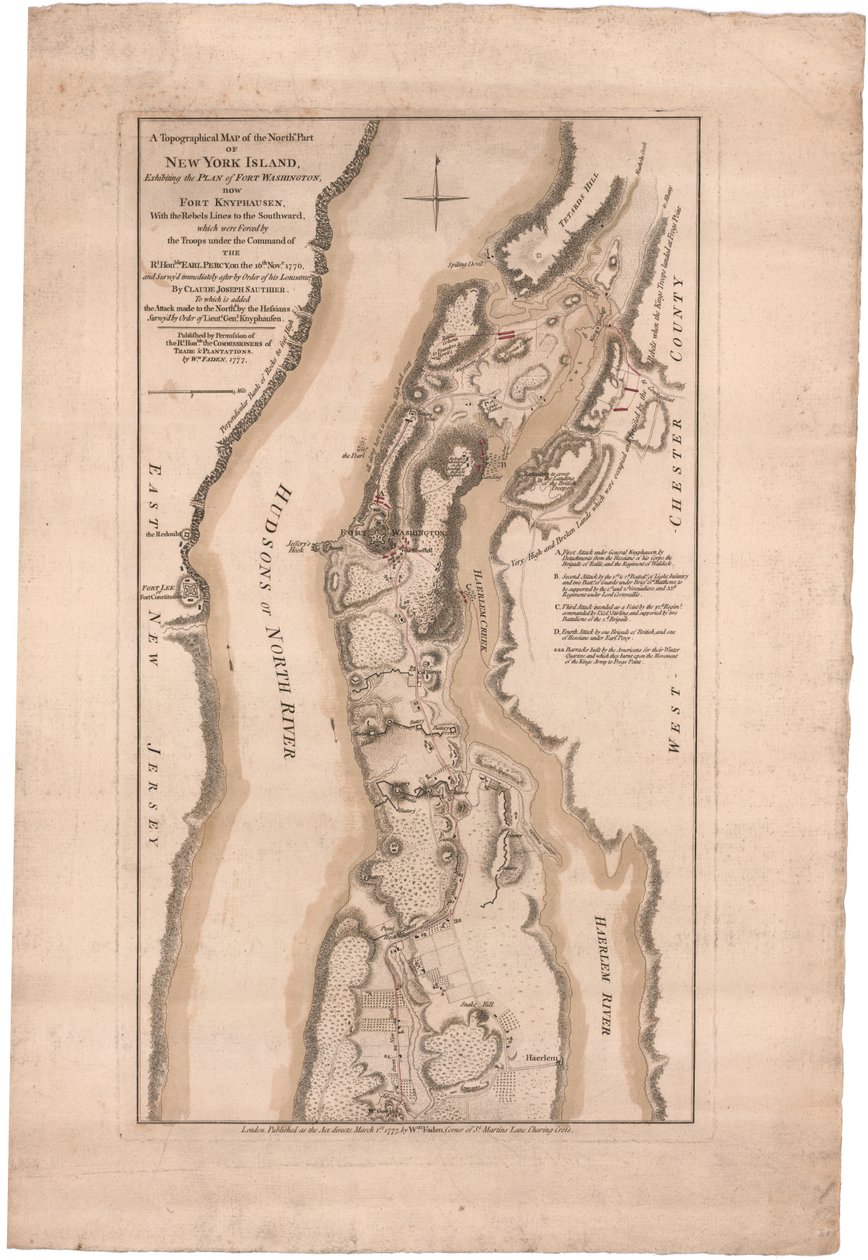
A Topographical Map of the Northern Part of New York Island by William Faden

A Topographical Map of the Northern Part of New York Island

(A Topographical Map of the Northern Part of New York Island by Sauthier)


William Faden

€ 0.00
Enthält ??% MwSt.
   Add to cart
   Configure art print
Undated  ·  engraving  ·  Picture ID: 1426851

Nonclassified artists

A Topographical Map of the Northern Part of New York Island by William Faden. Available as an art print on canvas, photo paper, watercolor board, uncoated paper or Japanese paper.
18th century · xviiith century · xviii · c18th · eighteenth century · 18 18th xviii xviiith century · 18 18th 18th 18th 18th 18th century · 18 18th 18th 18th xviii 18th century · 18 18th xviii 18th century · early 18th century · 18 18th xviii xviiith eighteenth century · north america · america (continent) · cartography · colonialism · colour · color · coloured · colors · colours · colored · united states · u.s.a · united states of america · unites states of america · american · americans · america · u.s.a. · america american americans · ameerican · american american american american american american american american american · us-american · united kingdom · british · britain · britain british · great britain - british · britisch - britisch · united kngdom · brit · britons · great britain · europe · european · engraving · engraver · gravure engraving · american revolutionary war (1775-1783) · american war of independence · american revolutionary war · amerikanischer unabhängigkeitstag · american revolution · war of independance for america · war of independence (a) · page · servant · housemaid · domestic · maid · cleaner · cleaning lady · housekeeper · governess · attendant · butler · maidservant · chambermaids · maid servant · maps · nobody · Without anyone · no people · Without People · print · illustration · illustrations ·
zu Favoriten hinzufügen   Add to favorites    Select wall color    View painting in a room AR/3D   View in 3D / AR
0 Reviews

Configure art print

Picture Frame

Medium & Stretcher

Glass & Passepartout

Miscellaneous & Extras

 Save / compare configuration
Preview Icon

Summary

Gemälde
Veredelung
Keilrahmen
Museumslizenz

€ ???.??
(inkl. 20% MwSt)
   Add to cart

Produktionszeit: 2-4 Werktage
Bildschärfe: PERFEKT

Should you desire adjustments to brightness and color, or a custom crop of the motif, we are happy to make these changes at no additional cost to you. Please do not hesitate to contact us.

Similar artworks selected for you

A Plan of New York Island A plan of New York Island, with part of Long Island, Staten Island and East New Jersey, with a particular description of the engagement on the woody heights of Long Island between Flatbush and Brooklyn Plan of New York Island with Part of Long Island, Staten Island and East New Jersey and the Engagement on the Woody Heights of Long Island between the British Forces, under the command of General Sir William Howe A Plan of the Operations of the British Forces in Egypt from the Landing in Aboukir Bay on the 8th of March to the Battle of Alexandria March 21st Inclusive Wilmington and Cape Fear River, North Carolina British map of the Siege of Yorktown, 1781 Grosse Isle and Part of Lake Erie, 1796 A Plan of River St. Laurence by Jeffreys A sketch of the operations before Charlestown, the capital of South Carolina, c.1780 A Plan of Charlestown, S.C. by Faden The City of New York, as Laid Out by the Commissioners with the Surrounding Country, by Their Secretary and Surveyor John Randel, Jr., 1814 Chart of Ipswich Bay and Cape Ann, Atlantic coast of North America Map of the City of New York as Laid Out by the Commissioners, 1814 Map of Hoogly River Plan of the city of New York showing the made and swampland, 1856 A Map of the Northern Frontiers of Georgia by Campbell A Topographical Chart of Rhode Island Plan of the City of New York in North America Surveyed in the Years 1766 and 1767 Published in Faden The Course of Delaware River from Philadelphia to Chester, North America A Plan of the Town and Harbour of Boston and the Country adjacent Reconnaissance of King Plan of Choul and Surat River A plan of the operations of the King A Plan of the City of New York and Its Environs to Greenwich on the North (Hudson) River to Crown Point on the East River, Surveyed 1766, 1775 A Topographical Sketch of New York A plan of Fort Montgomery & Fort Clinton, 1774-1779 A Chart of the Harbour of Rhode Island and Narraganset Bay Plan of Charlestown, South Carolina Battle of Green Spring, Map of the Land on the Left Bank of the James River Opposite Jamestown in Virginia Where the Battle of July 6
Show more similar artworks

Other art prints by William Faden

Ancient Britain. Map. Ancient Asia Minor. Map. Ancient Greece. Aegean Sea. Asia Minor. Map. Ancient Gaul Map Ancient Egypt. Map. Map of ancient world Australia and New Zealand. New Holland. Map. Ancient Italy Map Eastern Roman Empire Map Ancient Spain and Portugal. Map. Palestine Map Western Part of Roman Empire. Map. Indians in the Fur Trade in Canada Plan of the City of New York in North America Surveyed in the Years 1766 and 1767 Published in Faden A Chart of the Atlantic or Western Ocean, showing the track of Nelson
Discover more works by William Faden

Excerpt from our top sellers

Napoleon Crossing the Alps on 20th May 1800 Cleopatra Disembarking at Tarsus Hunters in the Snow The Embrace Lilith Silenus and the Young Satyr, East Wall, Oecus 5, 60-50 BC Moon, illustration from Two Embracing Women Lavater Lee and Sons, acrobats Intersecting Lines Sleeping Girl on a Wooden Bench The Night Café in Arles Water Lilies Dance from the series The Arts The Coronation of the Virgin Paradise
Show More Artworks


What our customers think about us


Frequently Asked Questions about Meisterdrucke


Personalizing your art print at Meisterdrucke is a simple and intuitive process that allows you to design an artwork exactly to your specifications: Choose a frame, determine the image size, decide on a printing medium, and add suitable glazing or a stretcher frame. We also offer customization options such as mats, fillets, and spacers. Our customer service is available to help you design your perfect artwork.

At Meisterdrucke, you have the fascinating option to visualize the artwork you configured directly in your own space. For a tailored preview, simply upload a photo of your room and let the artwork appear on it. If you visit us via a mobile device, be it a phone or tablet, our augmented reality feature brings the image to life and seamlessly projects it into your space. An experience that uniquely combines art and technology.

Choosing the medium is often a matter of personal taste. To give you a clearer idea, we have provided some images for each medium. For a holistic experience, we also offer you a sample set of all paper variants so you can make a decision not just visually but also haptically. You can take advantage of the sample set free of charge – only the shipping costs will apply. You can order the sample set directly.

Do not worry. At Meisterdrucke, we do not proceed mechanically. We manually review each order. If there are any inconsistencies or peculiarities in the configuration, we will immediately contact you. Of course, our courteous and patient support is always at your side to assist you with the configuration. Together with you, we adjust your image by phone or email so that the final result exactly meets your expectations.


Do you have any questions?

Are you interested in an art print from our manufactory but still unsure? Do you need advice on choosing the medium or help with the order?

Our experts are happy to assist you.

+43 4257 29415
support@meisterdrucke.com
Mo-Do: 7:00 - 16:00 | Fr: 7:00 - 13:00

Do you have any questions?

Are you interested in an art print from our manufactory but still unsure? Do you need advice on choosing the medium or help with the order?

Our experts are happy to assist you.

+43 4257 29415
support@meisterdrucke.com
Mo-Do: 7:00 - 16:00 | Fr: 7:00 - 13:00


Meisterdrucke

   Kärntner Strasse 46
        9586 Finkenstein am Faaker See
        Austria
        +43 4257 29415
        support@meisterdrucke.com
Other languages

                   
Erfahrungen & Bewertungen zu Meisterdrucke
Partner Logos

Kaiser Franz Joseph

Meisterdrucke
Kärntner Strasse 46
9586 Finkenstein am Faaker See · Austria
+43 4257 29415 · office@meisterdrucke.com
Partner Logos


(c) 2023 meisterdrucke.uk