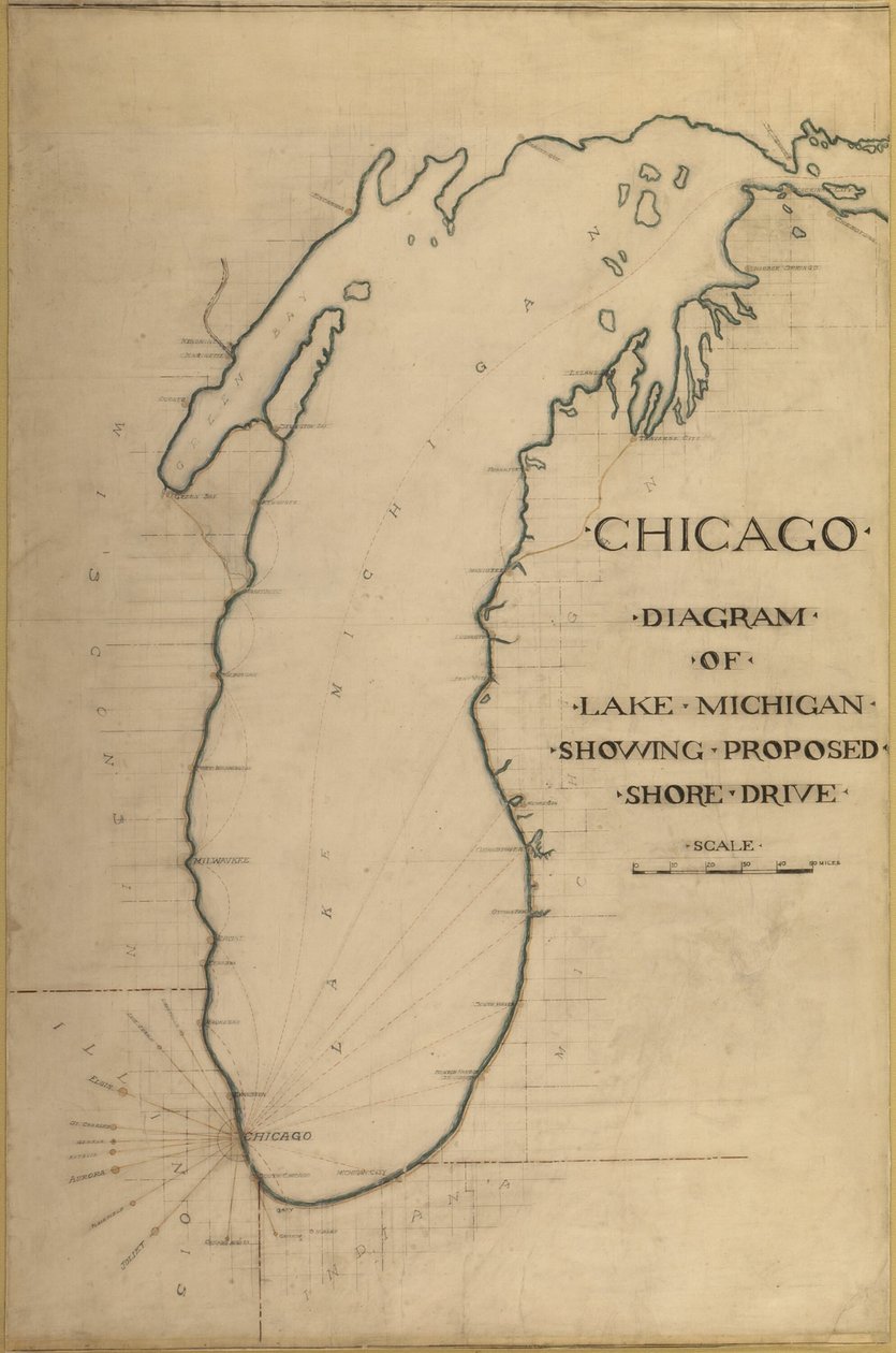
Plate 35 from Plan of Chicago 1909: Chicago, and Diagram of Lake Michigan. Proposed Roadway by Daniel Burnham

Plate 35 from Plan of Chicago 1909: Chicago, and Diagram of Lake Michigan. Proposed Roadway

(Plate 35 from Plan of Chicago 1909: Chicago, and Diagram of Lake Michigan. Proposed Roadway... )


Daniel Burnham

€ 126.23
Enthält 0% MwSt.
   Configure art print
Undated  ·  pencil  ·  Picture ID: 1179339

Nonclassified artists

Plate 35 from Plan of Chicago 1909: Chicago, and Diagram of Lake Michigan. Proposed Roadway by Daniel Burnham. Available as an art print on canvas, photo paper, watercolor board, uncoated paper or Japanese paper.
transport · transportation · road · planning · historical · arts · country · detail · lake · geography · chicago · illinois · text · location · century · drawing · gallery · plan · diagram · lake michigan · concept · layout · town planning · lettering · graphite · art gallery · titled · united states of america · description · black white · black and white · 1900s · 20th century · urban planning · american · history · historic · america · geographical feature · pencil drawing · pencil · united states · art institute of chicago · art centre · heritage art · graphite and colored pencil on paper · art institute chicago · architecture and design · daniel burnham · burnham · daniel · daniel hudson burnham · dh burnham co · dh burnham · Heritage Art/Heritage Images
zu Favoriten hinzufügen   Add to favorites    Select wall color    View painting in a room AR/3D   View in 3D / AR
0 Reviews

Configure art print

Picture Frame

Medium & Stretcher

Glass & Passepartout

Miscellaneous & Extras

 Save / compare configuration
Preview Icon

Summary

Gemälde
Veredelung
Keilrahmen
Museumslizenz

€ 126.23
(inkl. 20% MwSt)
   Add to cart

Bildschärfe: PERFEKT

Should you desire adjustments to brightness and color, or a custom crop of the motif, we are happy to make these changes at no additional cost to you. Please do not hesitate to contact us.

Similar artworks selected for you

Particular Map of a Part of Louisiana Where the Rivers and Routes Were Estimated and Measured by Steps, by Messrs. Broutin, de Vergés, Engineers & Saucier, Draughtsman Map of the Great Lakes The City of New York, as Laid Out by the Commissioners with the Surrounding Country, by Their Secretary and Surveyor John Randel, Jr., 1814 Grosse Isle and Part of Lake Erie, 1796 Plan of the harbour of Praslin, late 18th to early 19th century A Chart of the Harbour of Rhode Island and Narragansett Bay A Topographical Map of the Northern Part of New York Island Map of the City of New York as Laid Out by the Commissioners, 1814 A Chart of the Harbour of Rhode Island and Narraganset Bay The Atlantic Neptune, Published for the Use of the Royal Navy of Great Britain British map of the Siege of Yorktown, 1781 Plate 91 from The Plan of Chicago, Chicago, Proposed Diagonal Arteries, 1909 Plan of Choul and Surat River Map of East Africa (map of the route that Solomon fleets took) - in Journey to Nubia and Abyssinia undertaken to discover the sources of the Nile during the years 1768 to 1772, by James Bruce, Paris Map of New York and the Vicinity Map of Korea Chicago map Title Vignette and Prospect for Map of Christiansø Map of Chicago Showing Ward Boundaries Map showing location of Brobdingnag from first edition of Gulliver Printed Chart of the Estuary of the River Humber A Map of New York A Chart of the Gulf Stream, in Map of New York Island with the adjacent rocks and other remarkable parts of Hell-Gate Map of the State of New York Map of Korea, Japan and East China Plan of the Island of Bequia laid down by actual survey under the direction of the Honorable the Commissioners for the Sale of Lands in the Ceded Islands by John Byres Chief Surveyor 1776 The Atlantic Neptune, published for the use of the Royal Navy of Great Britain Map of Chile, Patagonia, Tierra del Fuego and the Falkland Islands, c.1798
Show more similar artworks

Other art prints by Daniel Burnham

Plan of Chicago, Chicago, Illinois, Diagram Showing City Growth Plan of Chicago, Plate 62, Plan of a Proposed Park, 1909 Plate 131 from The Plan of Chicago: Chicago. Elevation Showing the Group of Buildings Plate 110 from The Plan of Chicago: Chicago. Plan of the Complete System of Street Plan of Chicago, Chicago, Illinois, Railroad Circuits Diagram Plate 80 from The Plan of Chicago, 1909: Chicago. Diagram of City Center, Showing the Proposed Plate 75 from The Plan of Chicago: Chicago. Diagram of the City, Showing Complete System Proposed Civic Center Square, Plan of Chicago Plate 129 from The Plan of Chicago, 1909: Chicago. The Business Center of the City Sketch Taken at Algiers, North Africa, Travel Sketch Potomac Round Point, Washington D.C., Plan Sketch Plate 114 from The Plan of Chicago, 1909: Chicago. Proposed Boulevard and Parkway on Michigan Plate 91 from The Plan of Chicago, Chicago, Proposed Diagonal Arteries, 1909 Orchestra Hall, Chicago, Illinois, Section Plate 72 from The Plan of Chicago, 1909: Chicago. Sketch Diagram of Docks Suggested at the Mouth
Discover more works by Daniel Burnham

Excerpt from our top sellers

Quai du Louvre The Water Lily Pond, Evening Naked Young Man Sitting by the Sea, 1836 The Interior of the Palm House Snow at Benzaiten Shrine in the Pond of Inokashira, 1843-1847 Hypnosis School of Athens, from the Stanza della Segnatura, 1510-11 Nocturne in Black and Gold, the Falling Rocket Pandora Praying Hands View of Constantinople and the Bosphorus A Tower of Blue Horses Head of a Skeleton with a Burning Cigarette The Bookworm Beethoven Frieze
Show More Artworks


What our customers think about us


Frequently Asked Questions about Meisterdrucke


Personalizing your art print at Meisterdrucke is a simple and intuitive process that allows you to design an artwork exactly to your specifications: Choose a frame, determine the image size, decide on a printing medium, and add suitable glazing or a stretcher frame. We also offer customization options such as mats, fillets, and spacers. Our customer service is available to help you design your perfect artwork.

At Meisterdrucke, you have the fascinating option to visualize the artwork you configured directly in your own space. For a tailored preview, simply upload a photo of your room and let the artwork appear on it. If you visit us via a mobile device, be it a phone or tablet, our augmented reality feature brings the image to life and seamlessly projects it into your space. An experience that uniquely combines art and technology.

Choosing the medium is often a matter of personal taste. To give you a clearer idea, we have provided some images for each medium. For a holistic experience, we also offer you a sample set of all paper variants so you can make a decision not just visually but also haptically. You can take advantage of the sample set free of charge – only the shipping costs will apply. You can order the sample set directly.

Do not worry. At Meisterdrucke, we do not proceed mechanically. We manually review each order. If there are any inconsistencies or peculiarities in the configuration, we will immediately contact you. Of course, our courteous and patient support is always at your side to assist you with the configuration. Together with you, we adjust your image by phone or email so that the final result exactly meets your expectations.


Do you have any questions?

Are you interested in an art print from our manufactory but still unsure? Do you need advice on choosing the medium or help with the order?

Our experts are happy to assist you.

+43 4257 29415
support@meisterdrucke.com
Mo-Do: 7:00 - 16:00 | Fr: 7:00 - 13:00

Do you have any questions?

Are you interested in an art print from our manufactory but still unsure? Do you need advice on choosing the medium or help with the order?

Our experts are happy to assist you.

+43 4257 29415
support@meisterdrucke.com
Mo-Do: 7:00 - 16:00 | Fr: 7:00 - 13:00


Meisterdrucke

   Kärntner Strasse 46
        9586 Finkenstein am Faaker See
        Austria
        +43 4257 29415
        support@meisterdrucke.com
Other languages

                   
Erfahrungen & Bewertungen zu Meisterdrucke
Partner Logos

Kaiser Franz Joseph

Meisterdrucke
Kärntner Strasse 46
9586 Finkenstein am Faaker See · Austria
+43 4257 29415 · office@meisterdrucke.com
Partner Logos


(c) 2025 meisterdrucke.uk