Scott

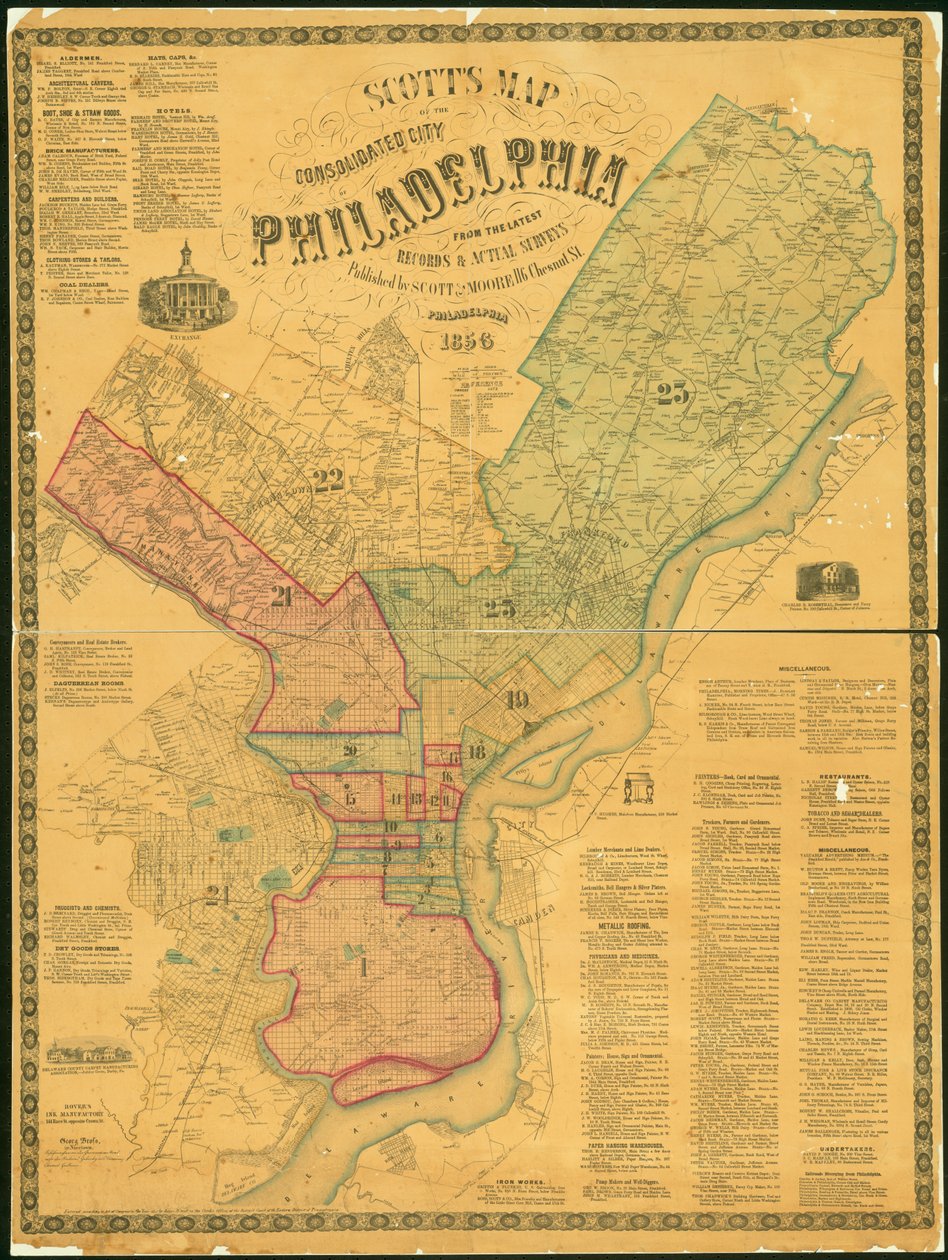
Scott's Map of the Consolidated City of Philadelphia, 1856

(Scotts Map of the Consolidated City of Philadelphia, 1856 (hand-coloured engraving))


James F. Scott

€ 117.86
Enthält 0% MwSt.
   Configure art print
1856  ·  hand-coloured engraving  ·  Picture ID: 365086

Nonclassified artists  ·  Cartography

Scott's Map of the Consolidated City of Philadelphia, 1856 by James F. Scott. Available as an art print on canvas, photo paper, watercolor board, uncoated paper or Japanese paper.
scotts · maps · mapping · cartography · urban · town · city · philadelphia · development · survey · blue · pink · yellow · north america · North American · Free Library of Philadelphia / Bridgeman Images
zu Favoriten hinzufügen   Add to favorites    Select wall color    View painting in a room AR/3D   View in 3D / AR
0 Reviews

Configure art print

Picture Frame

Medium & Stretcher

Glass & Passepartout

Miscellaneous & Extras

 Save / compare configuration
Preview Icon

Summary

Gemälde
Veredelung
Keilrahmen
Museumslizenz

€ 117.86
(inkl. 20% MwSt)
   Add to cart

Bildschärfe: PERFEKT

Should you desire adjustments to brightness and color, or a custom crop of the motif, we are happy to make these changes at no additional cost to you. Please do not hesitate to contact us.

Similar artworks selected for you

Philadelphia, 1848 Map of Philadelphia County, 1819 Plan of the City of Washington - The Capitol of the United States of America Map of the County of Philadelphia from Actual Survey, 1843 New-York City, County, and vicinity Map of the consolidated city of Brooklyn, 1861 Plan of New York [in Manhattan, as far north as 46th Street], 1860 A Map of the County of Philadelphia, from Actual Survey Johnsons Map of New York State Fireman Chicago map Plan of the City of New-York [as far north as East 31st Street], 1817 Map of the City of New York [as far north as East 53rd Street], 1885 The City of New York: Longworth Map of the Country Thirty-Three Miles Around the City of New York Cities of New-York and Brooklyn Business Centre of New York at the Seaward End of Manhattan and environs, c1930s Map of the city of New York, showing its political divisions and subdivisions New map of New York City from the latest surveys showing all the ferries and steamship docks, elevated, subways electric and cross town car lines Chicago As It Is, Showing the Burnt District, from History of the Great Fires in Chicago and the West Map of the City of New York Map of the Township of Oxford, Boroughs of Frankford & Bridesburg with Parts of Bristol, N. Liberties and Cheltenham Townships, 1849 Map of the City of New-York [in Manhattan, as far north as 36th Street] Plate 5, Map of the Whole Incorporated City of Philadelphia, 1867 Rand McNally & Company Map of the City of New-York, 1854 Philadelphia in 1886 Map of the City of New York University of Virginia, Dismal Swamp, and City of Baltimore. Plates 29-30
Show more similar artworks

Other motives from the category Cartography

Map of the Siege of the Castle of Burgos, Published by William Blackwood and Sons, Edinburgh and London Map of Eastern North America: Florida to Chesapeake Bay Renaissance map of Europe, Jacopo Russo (after) 1528 A New Land and Water Map of the Entire Earth Map of Laputa (flying island top right) and Balnibarbii (main port Maldonada) from Part III: A Voyage to Laputa, Balnibarbi, Luggnagg, Glubbdubdrib, and Japan in Gulliver Ms. 988, Tome 3, fol. 39 Map of the town and citadel of Saint-Martin, Ile de Ré, from the Map of the Siege of Malta in 1565 Map Depicting The Invasions of England and Ireland With All Their Civil Wars Since the Conquest, c.1627 Plan of Paris, under the Reign of Henry II by Olivier Truschet and Germain Hoyau Map of the World, designed by Sebastien Cabot (c.1476-1557), 1544 World Map with Jerusalem in the Centre (from Wallis Renaissance map of Europe, Jacopo Russo (after) 1528 Map of the Saxon Heptarchy Map of Cambrai, from
View More from "Cartography"

Excerpt from our top sellers

The Last Supper The Garden at Giverny, 1900 Sailboats on the Wannsee Pillars of Creation (NIRCam and MIRI Composite) Almond Blossom The Geese Circe The Art of Painting Strolling along the Seashore, 1909 Illustration to the Divine Comedy by Dante Alighieri Abyss of Hell The Battle of Trafalgar, 1805 View of Constantinople and the Bosphorus Madonna of the Yarnwinder Rocky Mountain Landscape Woman at Dawn
Show More Artworks


What our customers think about us


Frequently Asked Questions about Meisterdrucke


Personalizing your art print at Meisterdrucke is a simple and intuitive process that allows you to design an artwork exactly to your specifications: Choose a frame, determine the image size, decide on a printing medium, and add suitable glazing or a stretcher frame. We also offer customization options such as mats, fillets, and spacers. Our customer service is available to help you design your perfect artwork.

At Meisterdrucke, you have the fascinating option to visualize the artwork you configured directly in your own space. For a tailored preview, simply upload a photo of your room and let the artwork appear on it. If you visit us via a mobile device, be it a phone or tablet, our augmented reality feature brings the image to life and seamlessly projects it into your space. An experience that uniquely combines art and technology.

Choosing the medium is often a matter of personal taste. To give you a clearer idea, we have provided some images for each medium. For a holistic experience, we also offer you a sample set of all paper variants so you can make a decision not just visually but also haptically. You can take advantage of the sample set free of charge – only the shipping costs will apply. You can order the sample set directly.

Do not worry. At Meisterdrucke, we do not proceed mechanically. We manually review each order. If there are any inconsistencies or peculiarities in the configuration, we will immediately contact you. Of course, our courteous and patient support is always at your side to assist you with the configuration. Together with you, we adjust your image by phone or email so that the final result exactly meets your expectations.


Do you have any questions?

Are you interested in an art print from our manufactory but still unsure? Do you need advice on choosing the medium or help with the order?

Our experts are happy to assist you.

+43 4257 29415
support@meisterdrucke.com
Mo-Do: 7:00 - 16:00 | Fr: 7:00 - 13:00

Do you have any questions?

Are you interested in an art print from our manufactory but still unsure? Do you need advice on choosing the medium or help with the order?

Our experts are happy to assist you.

+43 4257 29415
support@meisterdrucke.com
Mo-Do: 7:00 - 16:00 | Fr: 7:00 - 13:00


Meisterdrucke

   Kärntner Strasse 46
        9586 Finkenstein am Faaker See
        Austria
        +43 4257 29415
        support@meisterdrucke.com
Other languages

                   
Erfahrungen & Bewertungen zu Meisterdrucke
Partner Logos

Kaiser Franz Joseph

Meisterdrucke
Kärntner Strasse 46
9586 Finkenstein am Faaker See · Austria
+43 4257 29415 · office@meisterdrucke.com
Partner Logos


(c) 2025 meisterdrucke.uk