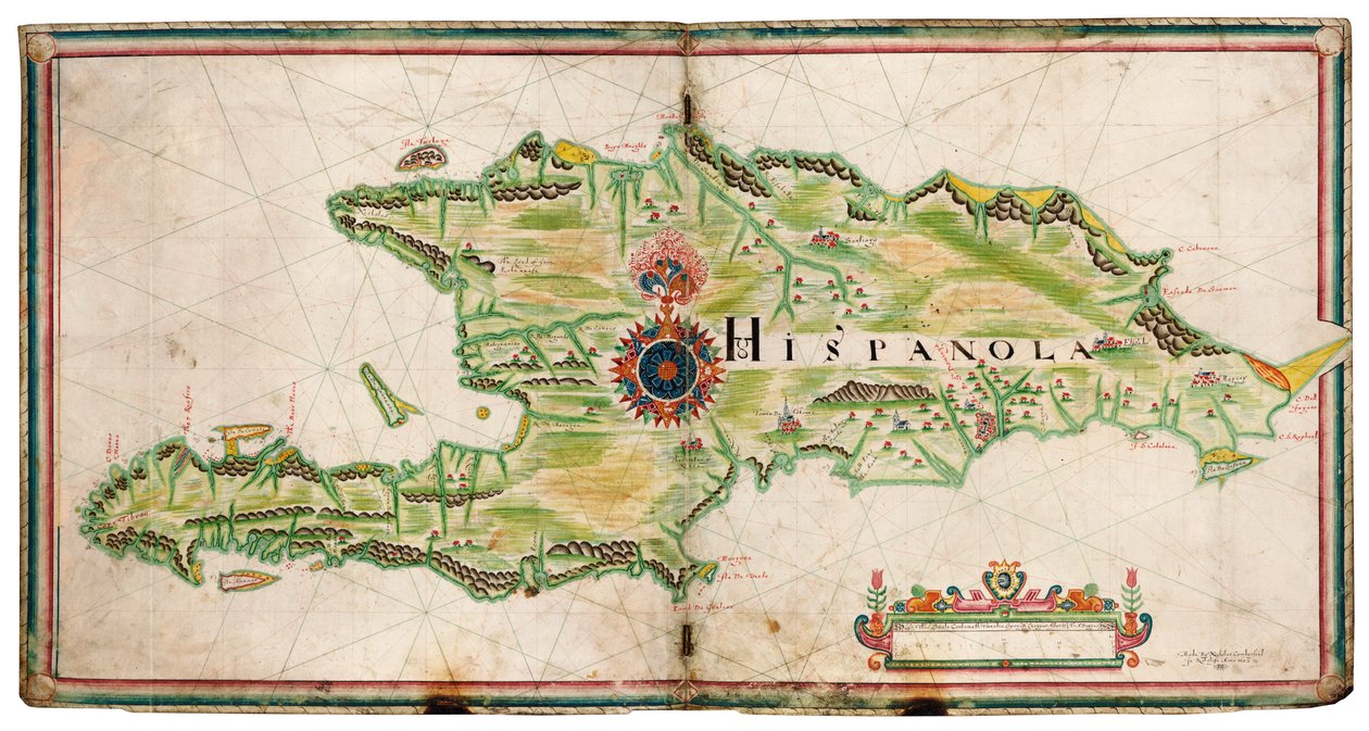
Map of Hispaniola by Nicholas Comberford

Map of Hispaniola


Nicholas Comberford

€ 104.43
Enthält 0% MwSt.
   Configure art print
Undated  ·  manuscript  ·  Picture ID: 1509688

Nonclassified artists

Map of Hispaniola by Nicholas Comberford. Available as an art print on canvas, photo paper, watercolor board, uncoated paper or Japanese paper.
17th century · america (continent) · central america · north america · west indies · cartography · colour · geography · haiti · island · coast · manuscript · map · Santo Domingo · · National Maritime Museum, London, UK / Bridgeman Images
zu Favoriten hinzufügen   Add to favorites    Select wall color    View painting in a room AR/3D   View in 3D / AR
0 Reviews

Configure art print

Picture Frame

Medium & Stretcher

Glass & Passepartout

Miscellaneous & Extras

 Save / compare configuration
Preview Icon

Summary

Gemälde
Veredelung
Keilrahmen
Museumslizenz

€ 104.43
(inkl. 20% MwSt)
   Add to cart

Bildschärfe: PERFEKT

Should you desire adjustments to brightness and color, or a custom crop of the motif, we are happy to make these changes at no additional cost to you. Please do not hesitate to contact us.

Similar artworks selected for you

The Earliest Known Separate Map of the Island of Ireland, Portolan Atlas Sicily and the Straits of Messina, from a Nautical Atlas, 1646 The English Pursue the Spanish Fleet East of Plymouth on 31 July - 1 August The English and Spanish fleets between Portland Bill and the Isle of Wight on 2 - 3 August 1588 Map of Central America and Peru The Battle off the Isle of Wight on 4 August Central Ireland, Dublin to Sligo Map of the Caribbean Sea by Christophe Plantin Straits of Magellan (engraving) Map of Florida, from Pascatway River in New England, c.1660-85 England, East Coast, Spurn Head to South Foreland Province of Munster, Ireland, c.1595 Atlantic 5 degrees South to 56 degrees North The islands of the Greater Antilles and the Lesser Antilles in the Caribbean Sea (map) Atlantic Ocean, 5 degrees south to 57 degrees north Map of Portugal, from Theatrum Orbis Terrarum Sicily from portolan atlas consisting of six charts, Parchment. 1646 Map of the Magellan Straits, Patagonia, from the Mercator Atlas pub. by Jodocus Hondius Amsterdam, 1606 The Famous West Indian Voyage Made by the English Fleet of 23 Ships and Barks Map of Europe, from a Facsimile of the Map of the Mediterranean, 1625 Chart of the coasts of Asia and Africa from Cape Comorin to Cape Delgado, including the Persian Gulf and the Red Sea, from the The English and Spanish Fleets on 1 - 2 August The battle off the Isle of Wight on 4 August Harbor of Palos, by Abraham Ortelius (1528-1598), Plate Map of Egypt, from the Portland Bill to Portsmouth: The Pursuit of the Spanish Armada by the English Fleet Map of Florida and Cuba
Show more similar artworks

Excerpt from our top sellers

Moonrise by the Sea Houses in Munich, 1908 Madonna with Child and Two Angels Dante and Virgil Vertumnus The Horse’s Bath Winter Landscape, 1835-8 Still Life with Compote Flute Concert with Frederick the Great in Sanssouci, 1850-1852 Red Tree Waterlilies at Sunset Mother of the World Antibes On White II, 1923 Nymphs and Satyr
Show More Artworks


What our customers think about us


Frequently Asked Questions about Meisterdrucke


Personalizing your art print at Meisterdrucke is a simple and intuitive process that allows you to design an artwork exactly to your specifications: Choose a frame, determine the image size, decide on a printing medium, and add suitable glazing or a stretcher frame. We also offer customization options such as mats, fillets, and spacers. Our customer service is available to help you design your perfect artwork.

At Meisterdrucke, you have the fascinating option to visualize the artwork you configured directly in your own space. For a tailored preview, simply upload a photo of your room and let the artwork appear on it. If you visit us via a mobile device, be it a phone or tablet, our augmented reality feature brings the image to life and seamlessly projects it into your space. An experience that uniquely combines art and technology.

Choosing the medium is often a matter of personal taste. To give you a clearer idea, we have provided some images for each medium. For a holistic experience, we also offer you a sample set of all paper variants so you can make a decision not just visually but also haptically. You can take advantage of the sample set free of charge – only the shipping costs will apply. You can order the sample set directly.

Do not worry. At Meisterdrucke, we do not proceed mechanically. We manually review each order. If there are any inconsistencies or peculiarities in the configuration, we will immediately contact you. Of course, our courteous and patient support is always at your side to assist you with the configuration. Together with you, we adjust your image by phone or email so that the final result exactly meets your expectations.


Do you have any questions?

Are you interested in an art print from our manufactory but still unsure? Do you need advice on choosing the medium or help with the order?

Our experts are happy to assist you.

+43 4257 29415
support@meisterdrucke.com
Mo-Do: 7:00 - 16:00 | Fr: 7:00 - 13:00

Do you have any questions?

Are you interested in an art print from our manufactory but still unsure? Do you need advice on choosing the medium or help with the order?

Our experts are happy to assist you.

+43 4257 29415
support@meisterdrucke.com
Mo-Do: 7:00 - 16:00 | Fr: 7:00 - 13:00


Meisterdrucke

   Kärntner Strasse 46
        9586 Finkenstein am Faaker See
        Austria
        +43 4257 29415
        support@meisterdrucke.com
Other languages

                   
Erfahrungen & Bewertungen zu Meisterdrucke
Partner Logos

Kaiser Franz Joseph

Meisterdrucke
Kärntner Strasse 46
9586 Finkenstein am Faaker See · Austria
+43 4257 29415 · office@meisterdrucke.com
Partner Logos


(c) 2025 meisterdrucke.uk