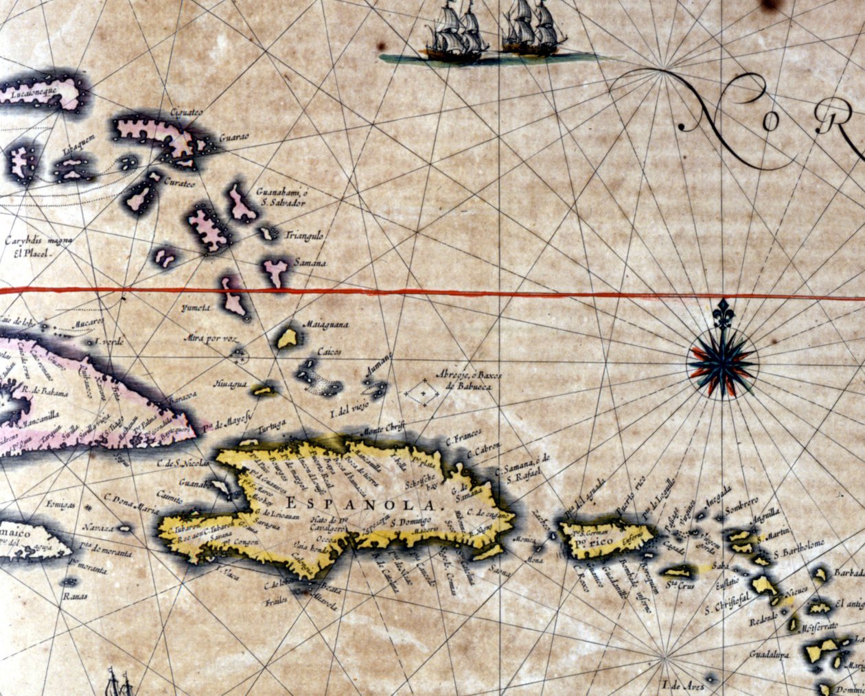
The Caribbean and Turtle Island on a map by Dutch cartographer Jansson Janssonius (17th century) by Jan Janssonius

The Caribbean and Turtle Island on a map by Dutch cartographer Jansson Janssonius (17th century)

(The Caribbean and Turtle Island (North West of Santo Domingo) on a map by Dutch cartographer Jansson Janssonius. 17th century)


Jan Janssonius

€ 110.52
Enthält 0% MwSt.
   Configure art print
Undated  ·  engraving  ·  Picture ID: 954735

Nonclassified artists

The Caribbean and Turtle Island on a map by Dutch cartographer Jansson Janssonius (17th century) by Jan Janssonius. Available as an art print on canvas, photo paper, watercolor board, uncoated paper or Japanese paper.
Private Collection / Bridgeman Images
zu Favoriten hinzufügen   Add to favorites    Select wall color    View painting in a room AR/3D   View in 3D / AR
0 Reviews

Configure art print

Picture Frame

Medium & Stretcher

Glass & Passepartout

Miscellaneous & Extras

 Save / compare configuration
Preview Icon

Summary

Gemälde
Veredelung
Keilrahmen
Museumslizenz

€ 110.52
(inkl. 20% MwSt)
   Add to cart

Bildschärfe: PERFEKT

Should you desire adjustments to brightness and color, or a custom crop of the motif, we are happy to make these changes at no additional cost to you. Please do not hesitate to contact us.

Similar artworks selected for you

Island of Timor and surrounding area Gulf of Mexico and the Caribbean, from Blaeu The Caribbean Sea: Gulf of Mexico and Caribbean Sea from the Atlas of Wilhelm Blaeu Map showing Bouro and Ceram (Seram), Indonesia Map of the Islands of Java; Madura; Bali and other islands Chart of Orcades Eylande (Orkneys) from van Keulen Map showing the Island of Crete, c.1570, by Abraham Ortelius The Caribbean Sea: The Bermuda Triangle between the Bermuda Archipelago, Miami, and Puerto Rico. According to Wilhelm Blaeu The Island of Crete, from a Nautical Atlas, 1651 (Detail) L Africa, Europe and part of Americas: Central America, from Atlas of the World in thirty-three Maps Western Atlantic Ocean Map of the East Indies, pub. 1635 in Amsterdam Adriatic chart Caribbean, Honduras and Florida, in A Double-Page Map of the Atlantic Ocean, Showing the East Coast of North and South America Molucca (Maluku) Islands, E. Indies, Indonesia Map showing Borneo, Clebes (Sulawesi), Java and other Indonesian islands Portulan: Geographic Map with the Name of the Coastline of Cuba, Florida, Central America and North Latin America Timorlant, etc Map showing part of the coast of China, and islands Majorca, Minorca, and Ibiza, including the coasts of Catalonia and Valencia, in Map of the Shetland Islands Map of East Africa and Madagascar Black Sea Map of the island of Malta Map of the Caribbean Sea by Christophe Plantin Map of the Mexican Archipelago The Windward Passage from Jamaica, Between the East End of Cuba, and the West End of Hispaniola
Show more similar artworks

Other art prints by Jan Janssonius

Map of the travels of Abraham, Isaac and Jacob, 1652 Map of the Castle and the City of Batavia, on the island of Java (now Jakarta, Indonesia) Map of the Guiana Region circa 1649 The Caribbean and Turtle Island on a map by Dutch cartographer Jansson Janssonius (17th century) Representation of the Seven Wonders of Antiquity: the Lighthouse of Alexandria. in the Atlas by Jansson Jannsonius printed in Amsterdam in 1630 Polus Antarcticus Representation of the Seven Wonders of Antiquity: the Pyramids of Egypt. Atlas of Jansson Jannsonius, 1630 Fishing scene and preparing fish at port city of Cadiz Janssonius Map of Persia Description of Guienne Herring Fishermen from the Atlas of Jansson Janssonius Accurate Delineation of the Islands of Hispaniola and Cuba with Surrounding Islands 1657 Map Polus Antarcticus Siege of Groningen (1594) 1631 Map - Typus Orbis Terrarum
Discover more works by Jan Janssonius

Excerpt from our top sellers

Female Nude Propping Herself Up with Long Hair Satan Viewing the Ascent to Heaven Circles in a Circle The Apple Tree A Storm in the Rocky Mountains, Mt. Rosalie The Great Wave off Kanagawa A Stroll on the Beach Twelve Sunflowers in a Vase Summer Evening on the Skagen Southern Beach with Anna Ancher and Marie Kroyer Portrait of a Young Woman The Stadtbahn Pavilion of the Vienna Underground Railway, Design Showing the Exterior and a View of the Railway Platform, c.1894-97 Birth of Jesus, from the Book of Hours of the Master of Jacques de Besançon Wandering Shadows View of Arles with Irises in the Foreground Garden in St. Germain, the European Quarter near Tunis. 1914
Show More Artworks


What our customers think about us


Frequently Asked Questions about Meisterdrucke


Personalizing your art print at Meisterdrucke is a simple and intuitive process that allows you to design an artwork exactly to your specifications: Choose a frame, determine the image size, decide on a printing medium, and add suitable glazing or a stretcher frame. We also offer customization options such as mats, fillets, and spacers. Our customer service is available to help you design your perfect artwork.

At Meisterdrucke, you have the fascinating option to visualize the artwork you configured directly in your own space. For a tailored preview, simply upload a photo of your room and let the artwork appear on it. If you visit us via a mobile device, be it a phone or tablet, our augmented reality feature brings the image to life and seamlessly projects it into your space. An experience that uniquely combines art and technology.

Choosing the medium is often a matter of personal taste. To give you a clearer idea, we have provided some images for each medium. For a holistic experience, we also offer you a sample set of all paper variants so you can make a decision not just visually but also haptically. You can take advantage of the sample set free of charge – only the shipping costs will apply. You can order the sample set directly.

Do not worry. At Meisterdrucke, we do not proceed mechanically. We manually review each order. If there are any inconsistencies or peculiarities in the configuration, we will immediately contact you. Of course, our courteous and patient support is always at your side to assist you with the configuration. Together with you, we adjust your image by phone or email so that the final result exactly meets your expectations.


Do you have any questions?

Are you interested in an art print from our manufactory but still unsure? Do you need advice on choosing the medium or help with the order?

Our experts are happy to assist you.

+43 4257 29415
support@meisterdrucke.com
Mo-Do: 7:00 - 16:00 | Fr: 7:00 - 13:00

Do you have any questions?

Are you interested in an art print from our manufactory but still unsure? Do you need advice on choosing the medium or help with the order?

Our experts are happy to assist you.

+43 4257 29415
support@meisterdrucke.com
Mo-Do: 7:00 - 16:00 | Fr: 7:00 - 13:00


Meisterdrucke

   Kärntner Strasse 46
        9586 Finkenstein am Faaker See
        Austria
        +43 4257 29415
        support@meisterdrucke.com
Other languages

                   
Erfahrungen & Bewertungen zu Meisterdrucke
Partner Logos

Kaiser Franz Joseph

Meisterdrucke
Kärntner Strasse 46
9586 Finkenstein am Faaker See · Austria
+43 4257 29415 · office@meisterdrucke.com
Partner Logos


(c) 2025 meisterdrucke.uk