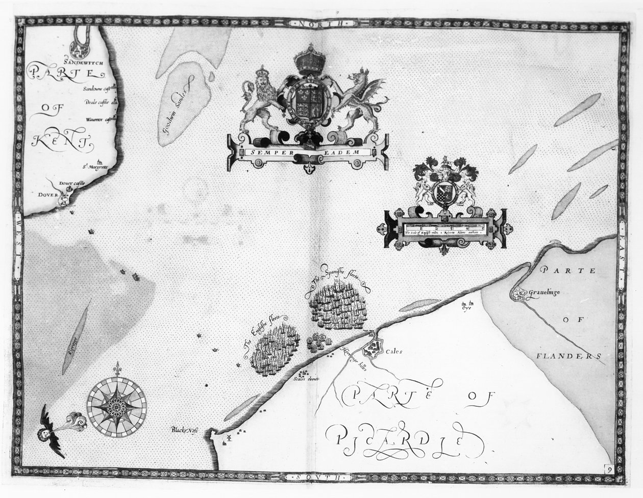
Map No.9 showing the route of the Armada fleet, engraved by Augustine Ryther, 1588 by Robert Adams

Map No.9 showing the route of the Armada fleet, engraved by Augustine Ryther, 1588

(Map No.9 showing the route of the Armada fleet, engraved by Augustine Ryther, 1588 )


Robert Adams

€ 0.00
Enthält ??% MwSt.
   Add to cart
   Configure art print
1588  ·  Gravur  ·  Picture ID: 64714

Nonclassified artists  ·  Cartography

Map No.9 showing the route of the Armada fleet, engraved by Augustine Ryther, 1588 by Robert Adams. Available as an art print on canvas, photo paper, watercolor board, uncoated paper or Japanese paper.
spanish fleet · sea battle · ship · naval · pursuing · chasing · escaping · english channel · coat of arms · coast · picardy · flanders · Private Collection / Bridgeman Images
Other color variations of this picture  
zu Favoriten hinzufügen   Add to favorites    Select wall color    View painting in a room AR/3D   View in 3D / AR
0 Reviews

Configure art print

Picture Frame

Medium & Stretcher

Glass & Passepartout

Miscellaneous & Extras

 Save / compare configuration
Preview Icon

Summary

Gemälde
Veredelung
Keilrahmen
Museumslizenz

€ 112.66
(inkl. 20% MwSt)
   Add to cart

Bildschärfe: PERFEKT

Should you desire adjustments to brightness and color, or a custom crop of the motif, we are happy to make these changes at no additional cost to you. Please do not hesitate to contact us.

Similar artworks selected for you

Map No.7 Showing the Route of the Armada Fleet, Engraved by Augustine Ryther, 1588 Map No.6 showing the route of the Armada fleet, engraved by Augustine Ryther, 1588 Map No.4 Showing the Route of the Armada Fleet, Engraved by Augustine Ryther Map No.8 Showing the Route of the Armada Fleet, Engraved by Augustine Ryther, 1588 Map Showing the route of the Armada fleet, engraved by Augustine Ryther Map No.2 Showing the route of the Armada fleet, engraved by Augustine Ryther, 1588 Dover to Sandwich and Blacknerse to Gravelines - The Spanish Armada and the English Fleet off Calais, c. 1590 Island Elba with Piombino, Italy The Capture of Cádiz in 1596 The Battle off Gravelines, 8 August 1588 The Harbour of Cape Cod, from Voyages de Sieur Champlain by Samuel de Champlain, Published in Paris, 1613 A New and Accurate Plan of the City and Harbour of Cartagena, Showing the Descent of That Place by the British Fleet and Land Forces, Under the Command of the Admirals Vernon and Ogle and General Wentworth in March & April 1741 Plan and map of the town, citadel and surroundings of Mont-Louis Plan of Rhodes (Rodos) - in Map of Normandy after an illustration from Theatrum Orbis Terrarum sive Atlas Novus by Willem and Joan Blaeu, plate representing Normandia Ducatus Map of Palestine, from a Passover Haggadah, printed in 1695 The English and Spanish fleets between Portland Bill and the Isle of Wight on 2 - 3 August 1588 The battle off the Isle of Wight on 4 August Turtle Island and Santo Domingo from a 17th century map by Pierre Vandier The Battle off the Isle of Wight on 4 August Plan of the Town and Harbour of Cartagena, Colombia Map of Lake Ontario with the English and French fleets Map of the Naval Battle between the Swedish and Danish Fleets in the Belt, 1644 (Freti Danici Orsundt Accuratissima Delineatio cum Regis Sueciae, Daniae et Hollandia classibg. Ao. 1644) The Thames Estuary from The Sea-Mirrour atlas by Willem Janszoon Blaeu, published in Amsterdam in 1633 Map of Brobdingnag, illustration from the first edition of Map showing location of the Houyhnhnms Land from first edition of Gulliver Plan of the Town and the Citadel of Saint-Martin-de-Re, Ile de Re
Show more similar artworks

Other art prints by Robert Adams

Map No.5 Showing the route of the Armada fleet, engraved by Augustine Ryther Map showing the route of the Armada fleet, engraved by Augustine Ryther, 1588 Map showing the route of the Armada fleet, engraved by Augustine Ryther Map Showing the route of the Armada fleet, engraved by Augustine Ryther Map No. 1 Showing the Route of the Armada Fleet, Engraved by Augustine Ryther Map No.9 showing the route of the Armada fleet, engraved by Augustine Ryther, 1588 Map No.4 Showing the Route of the Armada Fleet, Engraved by Augustine Ryther Map No.8 Showing the Route of the Armada Fleet, Engraved by Augustine Ryther, 1588 Map No.7 Showing the Route of the Armada Fleet, Engraved by Augustine Ryther, 1588 Map No.6 showing the route of the Armada fleet, engraved by Augustine Ryther, 1588 Map No.2 Showing the route of the Armada fleet, engraved by Augustine Ryther, 1588 Map No.10 showing the route of the Armada fleet, engraved by Augustine Ryther
Discover more works by Robert Adams

Other motives from the category Cartography

Map of Vicenza, Illustration from Map of Animals in Europe Part of the Tabula Peutingeriana, an illustrated itinerarium of the road network in the Roman Empire. Detail of Italy from the Peutinger map copy A Map of Mile End and Stepney Green, London, 1746 Map of Verona, from Map of Granada, from Map of Lisbon, from Map of London, from Map of Leipzig, from Map of Rome Map of Spain and Portugal showing the political divisions in the country at the death of Alfonso III, King of Leon, from Map of Granada, from Map of Flanders at the Time of the Thirty Years War (1618-48), from Map showing the world trade shipping routes, cartography by Pierre Duval published in 1686, Paris The City of Jerusalem and the surrounding area, detail from the Madaba mosaic map, Byzantine, 6th century
View More from "Cartography"

Excerpt from our top sellers

Several Circles Lady in the Garden Hylas and the Water Nymphs Morning in a Pine Forest Homage to Jacquin ( Women from Galicia at the Window Woman with a Veil Lowlands What Freedom! 1903 Red Boats, Argenteuil Asakusa Rice Fields During the Festival of the Cock, c.1857 The Course of Empire: Desolation Haystacks Water Lilies Reclining Nude
Show More Artworks


What our customers think about us


Frequently Asked Questions about Meisterdrucke


Personalizing your art print at Meisterdrucke is a simple and intuitive process that allows you to design an artwork exactly to your specifications: Choose a frame, determine the image size, decide on a printing medium, and add suitable glazing or a stretcher frame. We also offer customization options such as mats, fillets, and spacers. Our customer service is available to help you design your perfect artwork.

At Meisterdrucke, you have the fascinating option to visualize the artwork you configured directly in your own space. For a tailored preview, simply upload a photo of your room and let the artwork appear on it. If you visit us via a mobile device, be it a phone or tablet, our augmented reality feature brings the image to life and seamlessly projects it into your space. An experience that uniquely combines art and technology.

Choosing the medium is often a matter of personal taste. To give you a clearer idea, we have provided some images for each medium. For a holistic experience, we also offer you a sample set of all paper variants so you can make a decision not just visually but also haptically. You can take advantage of the sample set free of charge – only the shipping costs will apply. You can order the sample set directly.

Do not worry. At Meisterdrucke, we do not proceed mechanically. We manually review each order. If there are any inconsistencies or peculiarities in the configuration, we will immediately contact you. Of course, our courteous and patient support is always at your side to assist you with the configuration. Together with you, we adjust your image by phone or email so that the final result exactly meets your expectations.


Do you have any questions?

Are you interested in an art print from our manufactory but still unsure? Do you need advice on choosing the medium or help with the order?

Our experts are happy to assist you.

+43 4257 29415
support@meisterdrucke.com
Mo-Do: 7:00 - 16:00 | Fr: 7:00 - 13:00

Do you have any questions?

Are you interested in an art print from our manufactory but still unsure? Do you need advice on choosing the medium or help with the order?

Our experts are happy to assist you.

+43 4257 29415
support@meisterdrucke.com
Mo-Do: 7:00 - 16:00 | Fr: 7:00 - 13:00


Meisterdrucke

   Kärntner Strasse 46
        9586 Finkenstein am Faaker See
        Austria
        +43 4257 29415
        support@meisterdrucke.com
Other languages

                   
Erfahrungen & Bewertungen zu Meisterdrucke
Partner Logos

Kaiser Franz Joseph

Meisterdrucke
Kärntner Strasse 46
9586 Finkenstein am Faaker See · Austria
+43 4257 29415 · office@meisterdrucke.com
Partner Logos


(c) 2025 meisterdrucke.uk